 |
 |
 |
| Results are closed! |
| results? | right here! |
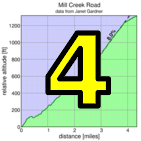
| profile | 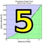 |
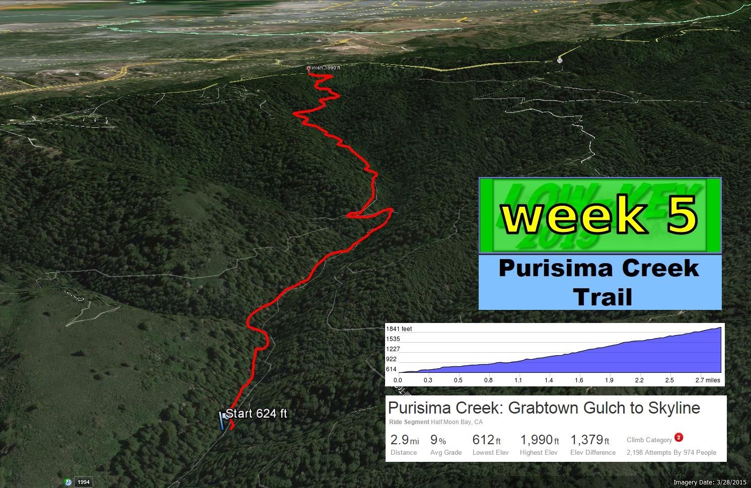
| distance | 2.98 miles (4.8 km) |
| climbing | 1345 ft (409 meters) |
| grade | 8.58% |
| where? | see below |
| when? | 31 Oct 2015 |
| what time | no registration needed climb starts @ 10 am, or any time Saturday |
| Result | Results are closed |
| how? |  |
| how much? | free! |
| why? | Ask not why; just do! |
| coordinator |  |
| volunteers | sign up! |
| aerial view | Google Earth |
| weather | Bay area winds |
| deja-vu? | New! |
| route map | |
Sorry, folks! Our insurance requires all riders wear helmets during the climb, and we follow the USA Cycling rule against ear buds or other head phones. Rock to tunes before the climb, perhaps, but we need riders to pay attention to what's happening during the climb...
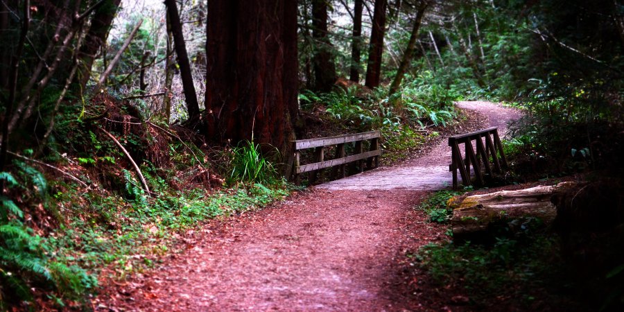
You're on your own this week! Purisima Creek Trail is at the junction of Higgens Canyon Road (also known as Higgens Purisima Road) and Purisima Creek Road, near Half Moon Bay. There's two primary options: one is to base yourself on Skyline, then carefully ride down the trail, the other is to base yourself on the western side, ride up, then descend. Whatever option you choose, be wary when descending because other Low-Keyers may be climbing the trail while you do so.
You can ride the trail any time you want. That said there's typically a group which will start at 10 am Low-Key Standard Time, and generally riding with others produces the best time if you're well matched.
It's recommended to bring a good GPS, maybe a back-up as well, and also to use your computer's lap function to get a time (start at Grabtown Gulch junction, end at fence).
There's many options to get within striking distance of the trailhead. For example, this Strava route from Colma BART: a very scenic route through Pacifica and Half Moon Bay, riding over Higgens Canyon Road. Your legs will be ready for action! From the south, there's Caltrain to for example Woodside, then up Kings Mountain Road, then either north on Skyline and descend either the trail (careful for climbing riders!) or descend Tunitas Creek to Verde to Purisima Creek Road. In short -- it's good to ride to the start!
This is a self-timed week, so we won't have check-in and results. However, there's still volunteer options! You can volunteer to help using our volunteer form! Thanks!!!
Low-Key is all about a group of friends riding up a hill together. It's like any other informal group ride, except we time you to the top and report the results on our web site. But we have no road closures, no lead vehicle, no follow vehicle. We are traffic, sharing the roads with other traffic, following the laws and courtesy which applies to traffic. This includes riding to the right of the road when practicable, and not crossing double yellows to pass riders or to get through corners faster. We're each responsible for our own actions out there, on and off the bike, both as users of the road as as courteous visitors to the neighborhoods we pass through. "Ceci n'est pas un race".